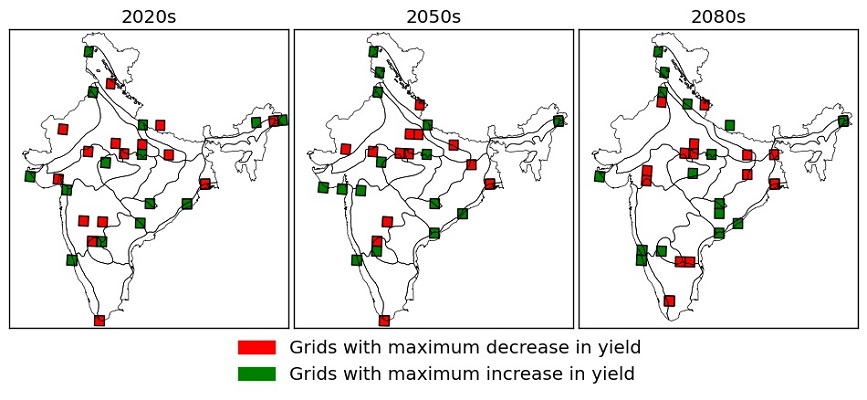
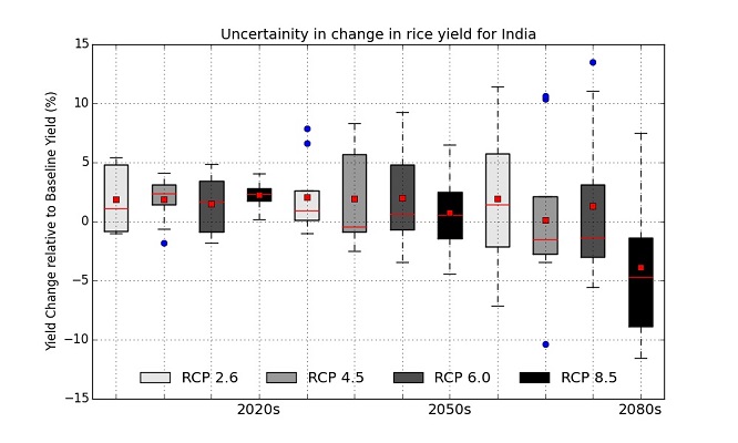
Climate Change Impact on Rice Yield of Agro-Ecological Zones of India
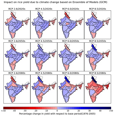
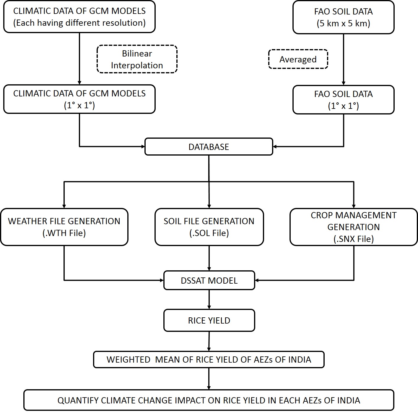
Analysis of climate change impact on rice yield of agro-ecological zones (AEZs) of India has been carried out by using a process-based crop simulation model- CERES-Rice fed with improved state of art climate projections from eight Global Climate Models (GCMs) for four expected climatic scenarios-Representative Concentration Pathways (RCP 2.6, 4.5, 6.0 and 8.5). Using weather, soil and crop management information as input to the crop model, simulations were performed for the base period (1976-2005) as well as three future periods (2020s: 2006-2035, 2050s: 2036-2065, and 2080s: 2066-2095) for insight understanding of climate change impact on rice yield. Model simulated rice yields of future periods were compared with that of the base period to quantify the climate change impact in order to capture the spatial as well as temporal yield change variability at the zone and country scale.
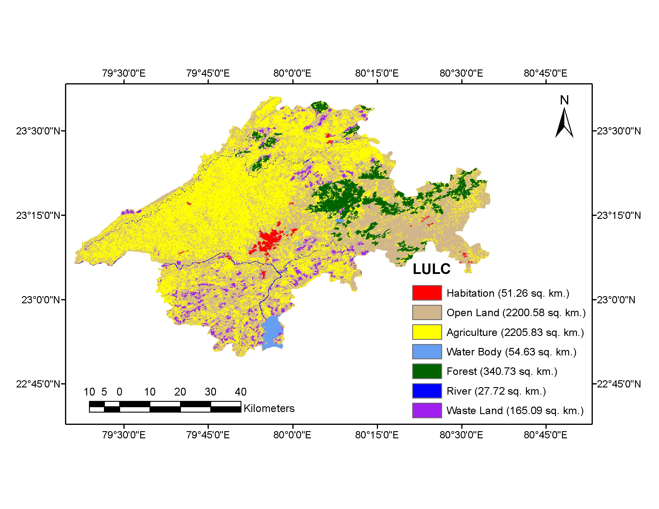
Land use/land cover mapping of Jabalpur District using Remote Sensing & GIS
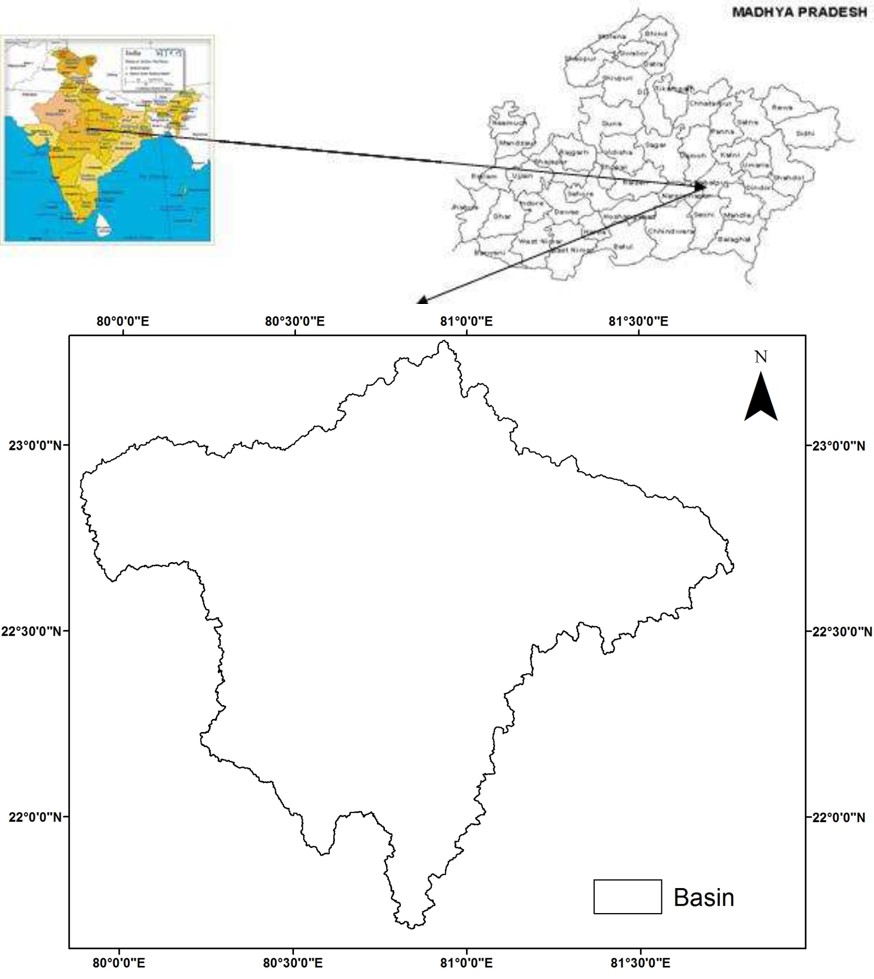
An attempt has been made to map out the status of land use/land cover (LULC) of Jabalpur District in the year 2000 with a view to detect the land consumption status by using both Geographical Information System and Remote Sensing. The mask of the entire Jabalpur District was generated from the LANDSAT imagery having a spatial resolution of 30 m. ERDAS Imagine software has been used as a tool to classify the image into different classes- wasteland, river, forest, water body, agriculture and open land, using unsupervised classification.
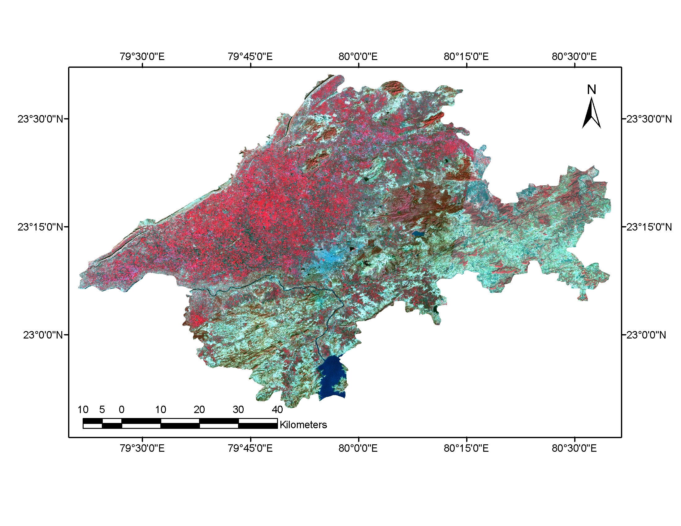
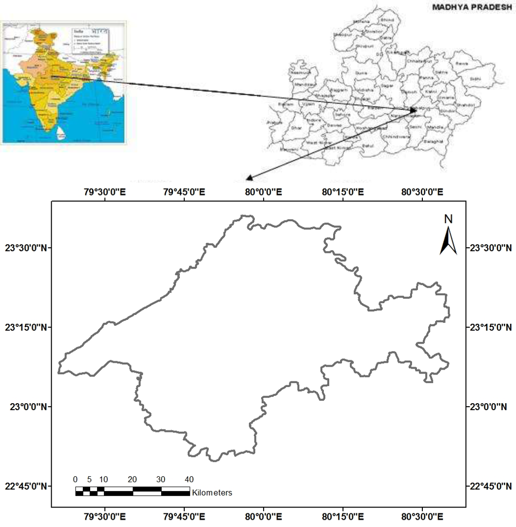
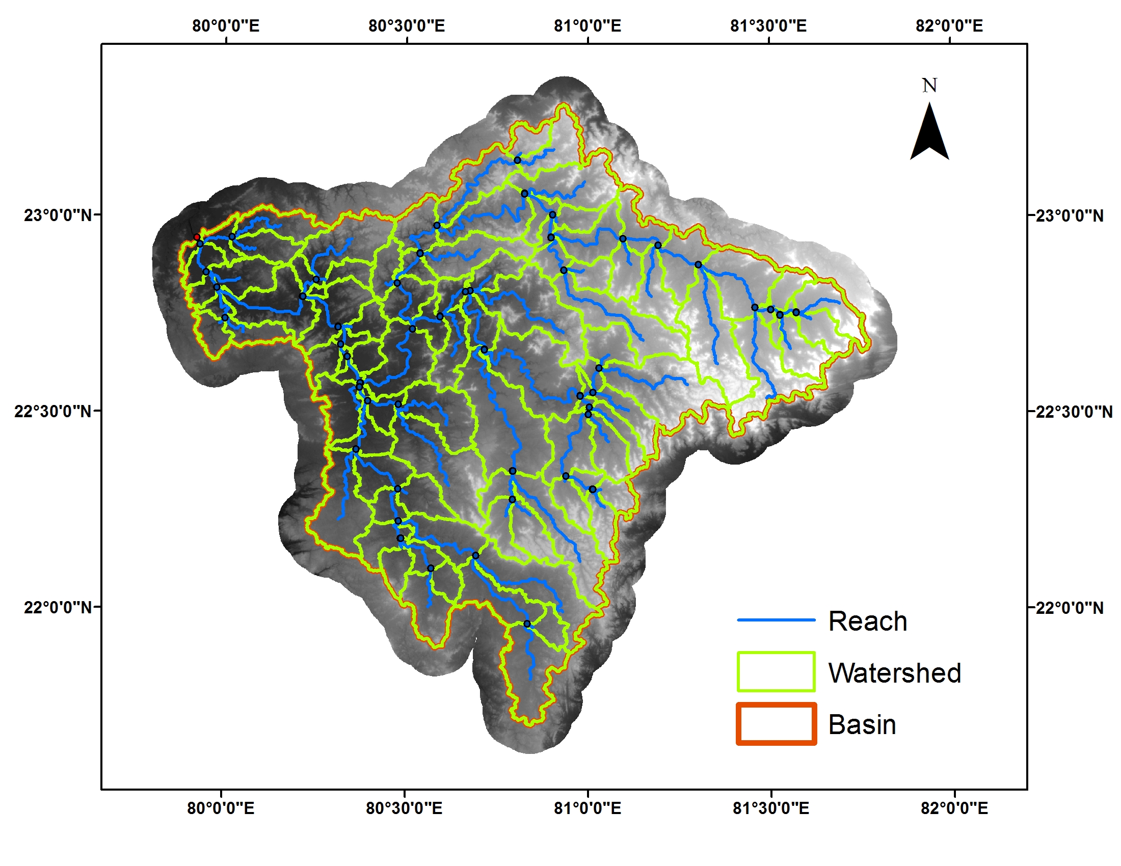
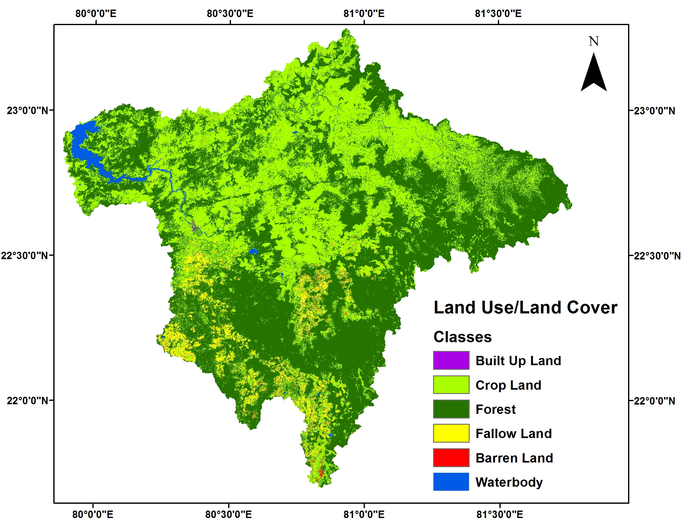
Hydrological simulation of Bargi catchment, Madhya Pradesh, India using SWAT Model
The main aim was to introduce with the Soil and Water Assessment Tool (SWAT: A widely used hydrological model). The comparison of the inflow obtained from hydrological simulation and inflow observed at the outlet of Bargi Catchment, Madhya Pradesh, India was carried out. The simulations were carried out using SWAT model on the Bargi catchment on Narmada River. The SWAT was implemented with ArcMap to delineate the basin and its sub-components using ASTER DEM (Digital Elevation Model), land use/land cover map derived from LANDSAT 8 imagery of May 2014 and soil information. After simulation, the derived runoff volume was compared and analyzed with respect to observed runoff volume.